Biscayne Bay looks like an easy, open bay from the Miami skyline, and most of it is. But between Key Biscayne and the northern Keys lies a band of shoals that catches boats every weekend: the Safety Valve, a comb of shallow sand banks with narrow cuts between them where the bay drains to the ocean. This guide reads our live depth map to show where those shoals are, and how they relate to Stiltsville, the sandbar off Key Biscayne and Boca Chita.
Depths are at low tide, the level US charts use. The map’s typical error is about 3 ft, so it is a strong guide to where the banks and cuts are, not a promise of exact clearance.
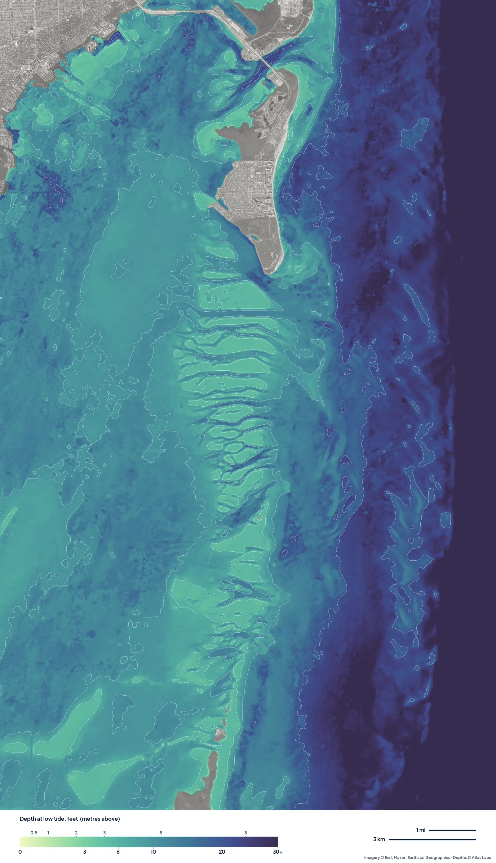
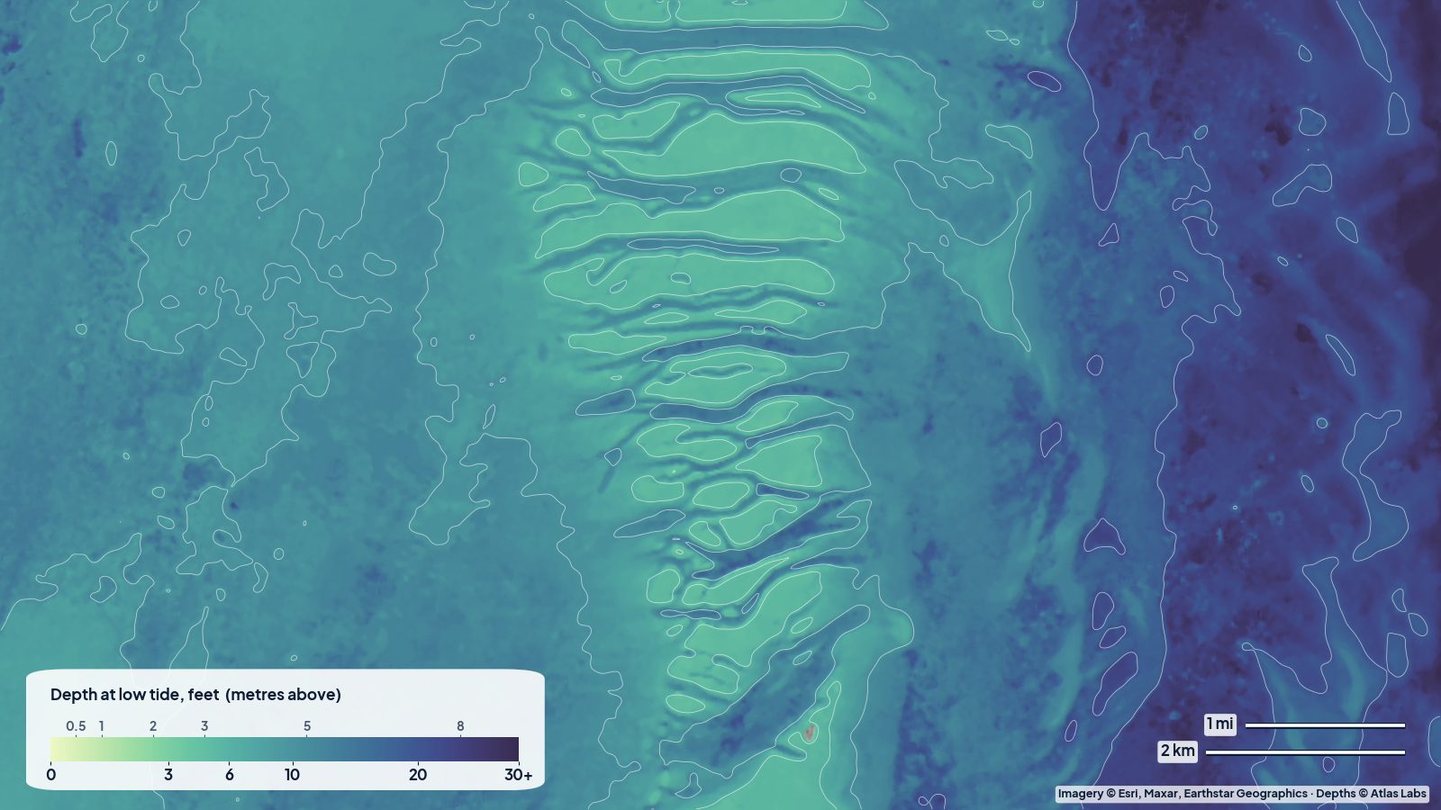
South Biscayne Bay at low tide. The comb of pale ridges and blue cuts east of the bay is the Safety Valve.
The Safety Valve
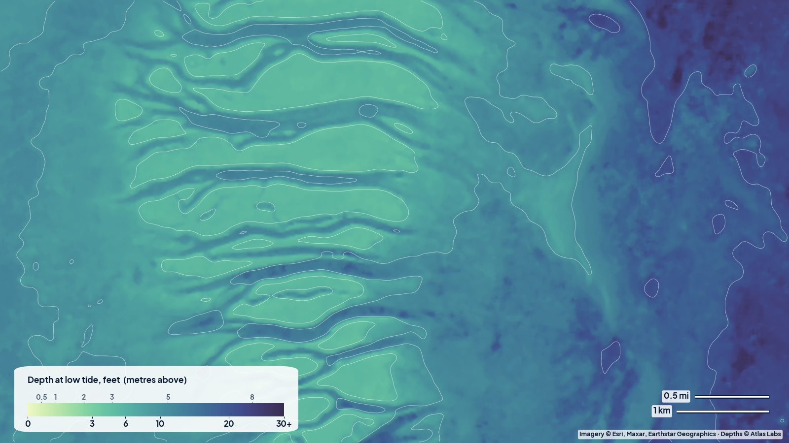
On the map the Safety Valve is impossible to miss: a row of pale, finger-like banks running east–west, separated by blue cuts. In the middle of that area, a quarter of the water reads under about 6 ft and the shallowest banks read 4 to 5 ft at low tide on the map, while the cuts between them read 11 to 13 ft.
What the map can’t show is the current. The Safety Valve is where the bay empties and fills, so the cuts run hard on a big tide, and wind against tide stacks up short, steep waves. If you are crossing it in a small boat, use a marked cut, go in good light, and expect the banks to be shallower than the map on a strong low.
Stiltsville and the flats off Key Biscayne
The stilt houses sit on the flats south of Cape Florida, and the map reads that area mostly 5 to 6 ft, with deeper patches around 10 ft. The popular sandbar area west of Key Biscayne reads about 5 to 9 ft on the map at low tide, getting shallower toward the bar itself. On a busy weekend these flats fill up with anchored boats, so arrive early and anchor on sand, not grass.
The open bay
West of the shoals, the body of the bay is remarkably even: the map reads 10 to 12 ft across a wide area. That is the easy water. The shallows are along the edges, around the islands and on the banks to the east.
Boca Chita and the northern Keys
At the south of this map, the water around Boca Chita Key reads about 5 to 7 ft, shallower close in. The small harbour there is popular and fills up fast on weekends; approach slowly.
Who the bay suits
- Kayaks and paddleboards: the flats along the shore and around the keys, launching from Key Biscayne or the national park visitor centre area. Stay out of the main channels.
- Flats skiffs: the edges of the Safety Valve banks and the flats around Stiltsville, on a moving tide.
- Bay boats and cruisers: the open bay is easy; treat the Safety Valve as a place to cross only through marked cuts.
Much of the south bay is part of Biscayne National Park, with manatee zones and seagrass protection. Running aground on grass leaves scars that take years to heal.
Open the live map
Tap any spot for the depth in feet: Biscayne Bay live map. For launches and spot details see the full Biscayne Bay guide, and for the area the Biscayne Bay spot hub.
Frequently asked questions
How shallow is the Safety Valve?
On our map, the shallowest banks read about 4 to 5 ft at low tide and the cuts between them about 11 to 13 ft. On a strong low with a north wind, expect less.
How deep is the water at Stiltsville?
The map reads mostly 5 to 6 ft at low tide around the stilt houses, with deeper patches around 10 ft.
What is the deepest part of Biscayne Bay?
Away from the dredged ship channels, the open bay reads an even 10 to 12 ft on our map.
Related reading
- Biscayne Bay depth map: Stiltsville, the sandbar and Elliott Key
- Florida Bay for skiffs: the channels off Flamingo
- How shallow are the Florida Keys flats?
Safety note: ShoalScope depth maps are satellite estimates for planning, not for navigation. Use official charts and marked channels, and always wear a life jacket.