The central Exumas are the postcard Bahamas: a line of low cays with the shallow, turquoise Exuma Bank on one side and the deep blue of Exuma Sound on the other. From a boat it can be hard to tell 4 ft of water from 14 ft, because both look the same shade of impossible blue. A depth map from above shows the pattern at a glance. This guide reads our live map of the area around Staniel Cay, Big Major Cay and Black Point on Great Guana Cay.
Depths are at low tide. The tide range here is roughly 2.5 to 3.5 ft, so at high water you will have noticeably more. This map has a typical error of about 2 ft, which is good for planning a route or a stop, not for threading a keel between sand bores.
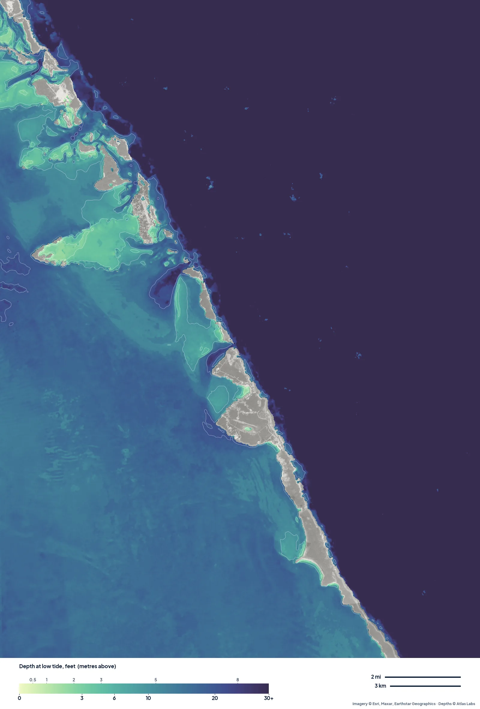
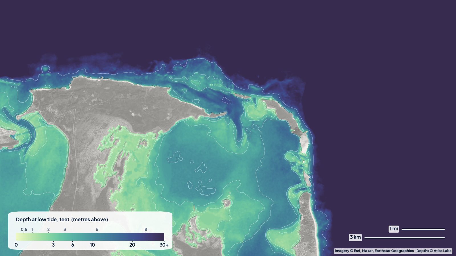
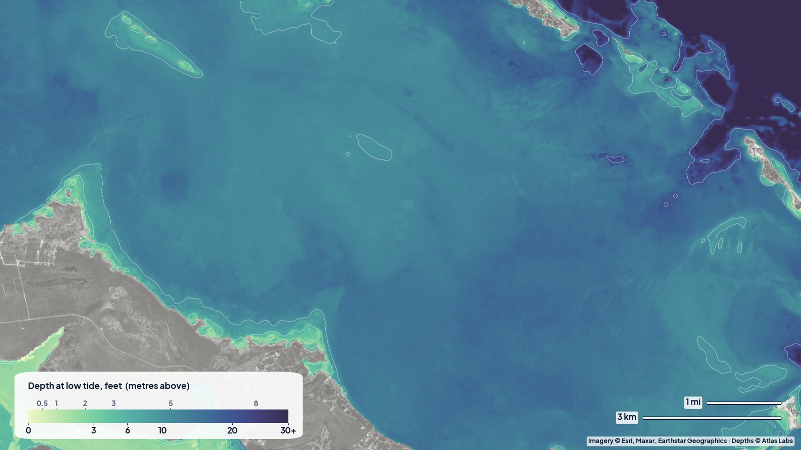
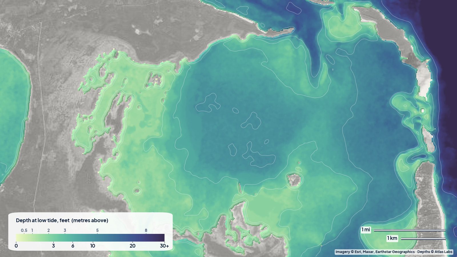
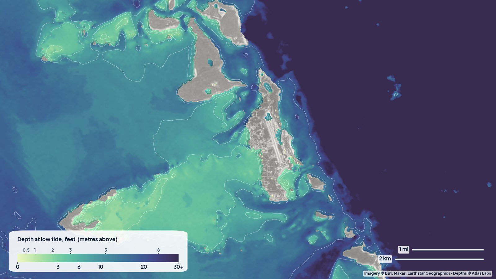
The central Exumas at low tide. West of the cays: the bank, pale near the islands and deeper teal further out. East of the chain: Exuma Sound, shown as one dark colour.
What the map shows
The bank west of the cays. Away from the islands, the Exuma Bank reads a fairly even 12 to 15 ft on the map. That is deeper than many people expect, and it is why boats can cross the bank in a straight line on a calm day.
The sand fans behind the cays. Close to the islands the picture changes. Behind Staniel Cay and Big Major Cay, and in the bights of Great Guana Cay, the map shows pale green fans and tongues of sand. Just west of Big Major, half the water within a mile reads under about 7.5 ft, and a quarter reads under 3 ft. These are the sandbars and bores that dry or nearly dry on a spring low, and the classic spots for a picnic on a sandbar.
The anchorages. Off Pig Beach on Big Major the map reads about 11 ft over sand, and the Staniel Cay anchorage area reads mostly 6 to 18 ft. Off Black Point settlement it reads about 9 to 10 ft. These match the “good holding in sand” reputation of these spots, but use the map to pick a patch, not as a guarantee of swinging room.
The cuts and Exuma Sound. East of the chain, the colour turns dark almost immediately. That is Exuma Sound, which drops to thousands of feet; our map simply shows it as “deeper than 30 ft”. The cuts between the cays are where the bank drains into the sound, so expect strong current there.
Using the map on the water
- Kayaks and paddleboards: the pale fans behind Staniel and Big Major are perfect for exploring at mid tide. On a falling tide, head back before the sand bores separate you from your boat.
- Dinghies: read the pale green as “might touch at low tide”. Plan dinghy runs across the fans at half tide or higher.
- Cruising boats: the open bank around 12 to 15 ft is the easy part. The shallow fans near the cays are where groundings happen. Approach anchorages in good light, sun behind you, and use the map plus your eyes.
When to go
December to April is the main season, with settled weather between cold fronts. Fronts bring a shift to west and north winds, which makes anchorages on the bank side uncomfortable; plan where you will hide before one arrives. Summer is calmer and hotter, with afternoon storms, and is hurricane season from June to November.
Open the live map
Tap any spot for the depth in feet: Exumas and Staniel Cay live map. For the snorkel spots, Thunderball Grotto, Pig Beach and the cuts, see the full Exumas and Staniel Cay depth guide, and for the rest of the islands the Bahamas spot hub.
Frequently asked questions
How deep is the Exuma Bank?
On our map, the open bank west of Staniel Cay reads about 12 to 15 ft at low tide, getting shallower close to the cays, where sand fans and bars read under 3 to 7 ft.
How deep is it at Pig Beach?
The map reads about 11 ft a little way off the beach over sand, getting shallower toward the shore.
Can I see the sandbars on the map?
Yes. The pale green fans behind the cays are the shallow sand. The bars move a little with storms, so treat the map as a guide and look for the colour change on the water.
Related reading
- Exumas and Staniel Cay depth map: anchorages and snorkel spots
- North Eleuthera shallow water guide
- Bimini channels and the bank
Safety note: ShoalScope depth maps are satellite estimates for planning, not for navigation. Use official charts and current cruising guides, and read the water in good light.