North Eleuthera is a small corner of the Bahamas with a lot going on in very little space: the pink-sand beaches of Harbour Island, the fishing town of Spanish Wells, the airport and the ferry dock on the mainland, and between them a sheltered bay of shallow sand and grass. Along the north shore runs the Devil’s Backbone, a reef line with a fearsome reputation. Our live depth map of the area shows how all of this fits together.
Depths are at low tide; the tide range is about 2.5 to 3 ft. This map has a typical error of a little over 1 ft, the best of our Bahamas maps so far, thanks to very clear water over pale sand. It is still a planning map, not a chart.
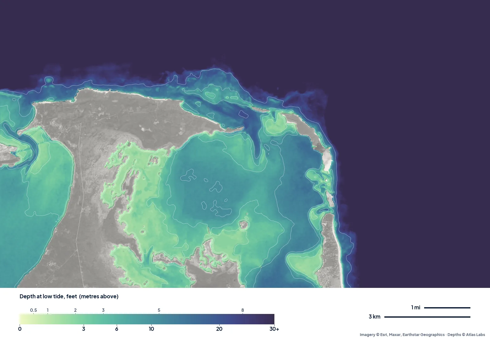
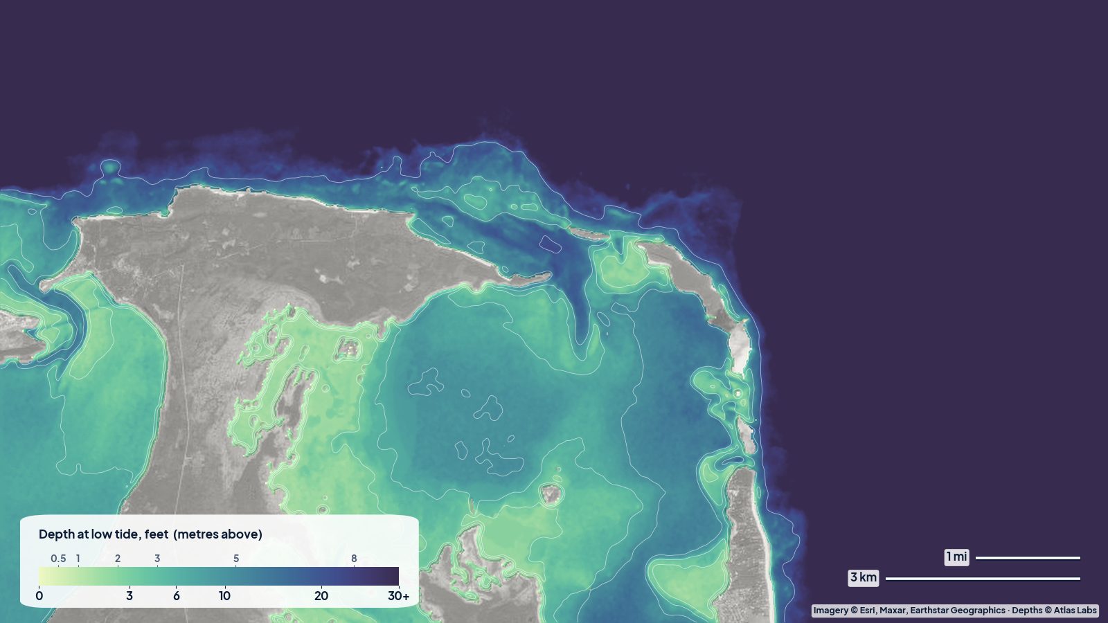
North Eleuthera and Harbour Island at low tide. The narrow shelf along the north shore is the Devil’s Backbone; inside, the bay mixes pale flats with a deeper basin.
The bay side of Harbour Island
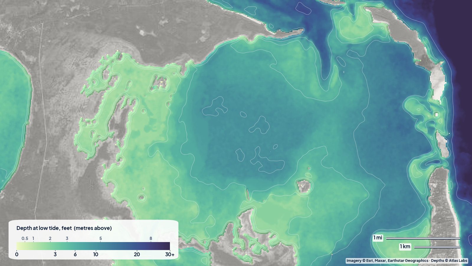
The long, thin island on the right of the map is Harbour Island, with its famous pink-sand beach on the ocean side. Its bay side is the opposite: wide, very shallow flats. On the map, the water just behind Harbour Island reads mostly 2 to 5 ft at low tide, with the shallowest pale-green patches under 2 ft. Further toward the middle of the bay it deepens to 5 to 7 ft.
That makes the lee of Harbour Island an easy, sheltered place for kayaks and paddleboards, and good bonefish water on the right tide.
The middle of the bay
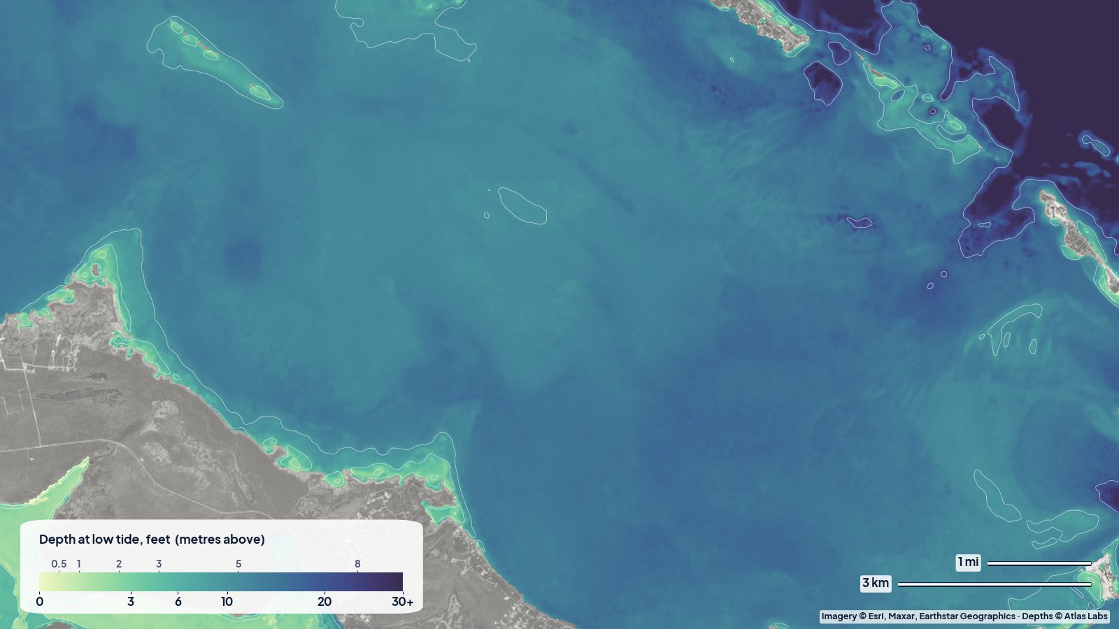
Between the mainland and Harbour Island, the map shows a rounded, deeper basin reading about 9 to 10 ft at low tide. This is where the water taxis run between the ferry dock on the mainland and Dunmore Town, and where boats find enough water to move freely.
On the western side of the bay, along the mainland shore, the map shows a broad band of pale green: flats reading 1.5 to 4 ft, with mangrove creeks cutting in. Great for exploring by kayak at mid tide, not for a boat with any draft on a low.
The Devil’s Backbone
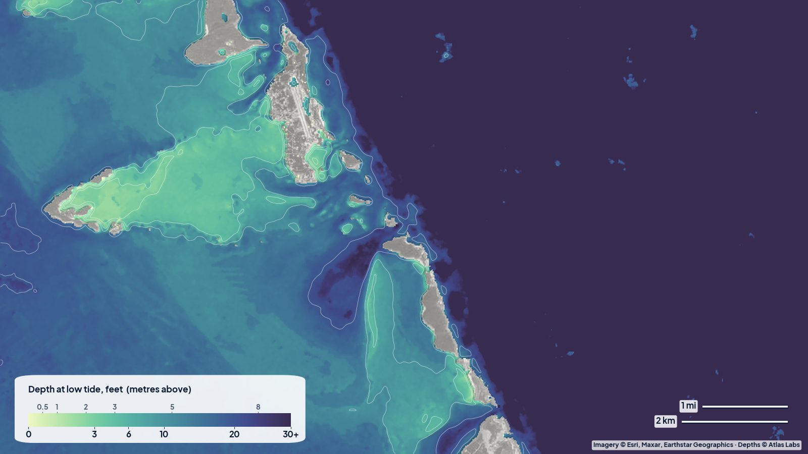
The reef shelf along the north shore of Eleuthera is the Devil’s Backbone, notorious for the wrecks it has collected over the centuries. On our map it shows as a narrow, uneven strip of water before the bottom drops into the open Atlantic, with depths that jump around a lot over short distances (the map reads anywhere from about 12 to 24 ft along it, and much shallower on the coral heads themselves, which are too small for a satellite map to show reliably).
The honest advice here has nothing to do with our map: boaters who don’t know the route use a local pilot through the Backbone. On a calm day it is a beautiful snorkel and dive area, best visited with a local guide.
Planning tips
- Kayaks and paddleboards: launch from the Harbour Island bay side or the mainland near the ferry dock, and stay on the flats; the deeper basin carries water-taxi traffic.
- Flats fishing: the pale flats on both sides of the bay, on the last of the falling tide and early rising tide.
- Boats: use the deeper basin to cross, approach the flats slowly, and treat the Devil’s Backbone as pilot-only water unless you know it well.
Open the live map
Tap any spot for the depth in feet: Eleuthera and Harbour Island live map. For access, beaches and snorkel spots see the full Eleuthera and Harbour Island guide, and for the rest of the islands the Bahamas spot hub.
Frequently asked questions
How deep is the water between Eleuthera and Harbour Island?
The middle of the bay reads about 9 to 10 ft at low tide on our map, with shallow flats on both sides.
Can you kayak on the bay side of Harbour Island?
Yes. The map reads mostly 2 to 5 ft there at low tide, sheltered from the ocean swell. Watch for water taxis in the deeper middle of the bay.
Why is the Devil’s Backbone dangerous?
It is a long line of shallow reef and coral heads close to the north shore of Eleuthera, with depths that change very quickly. Local pilots guide boats through it.
Related reading
- Eleuthera and Harbour Island depth map
- Exumas sandbanks around Staniel Cay
- Abacos depth map: the Sea of Abaco
Safety note: ShoalScope depth maps are satellite estimates for planning, not for navigation. Use official charts, local pilots where advised, and read the water in good light.