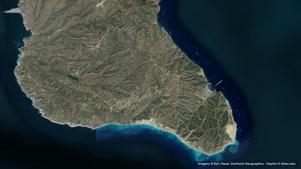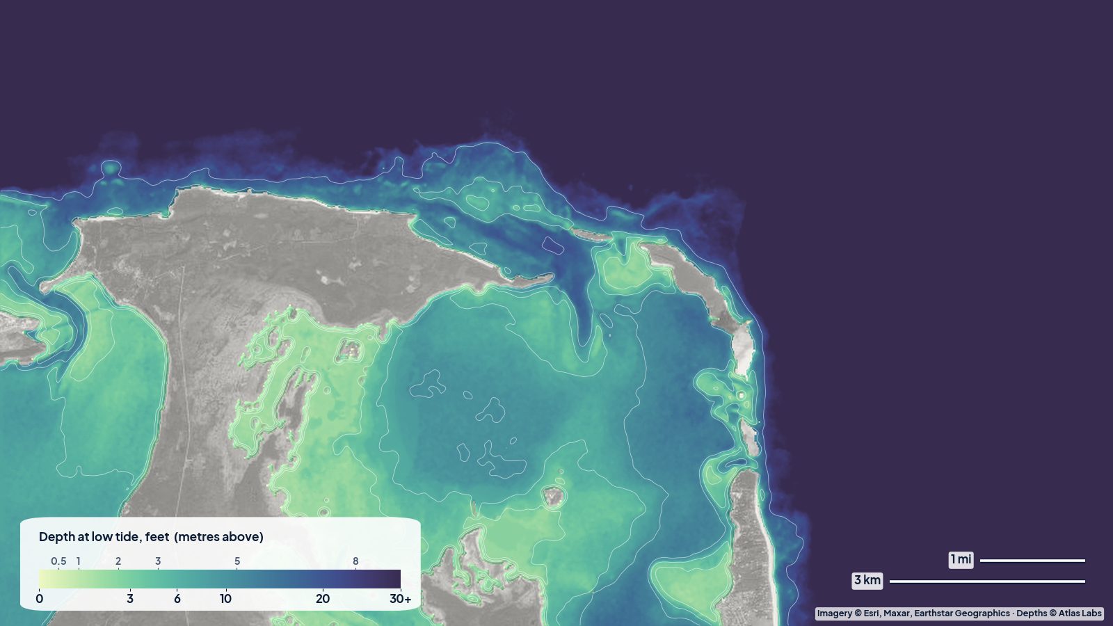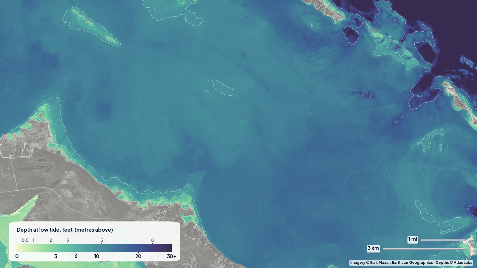
Jebel Dhanna is a low headland on Abu Dhabi’s far western coast, about three hours’ drive from the city, best known for its beach resorts and as the jumping-off point for Sir Bani Yas Island. Around it, the Gulf is shallow, warm and very clear on calm days, with sand banks that are hard to judge from the beach. Our live depth map shows the pattern.
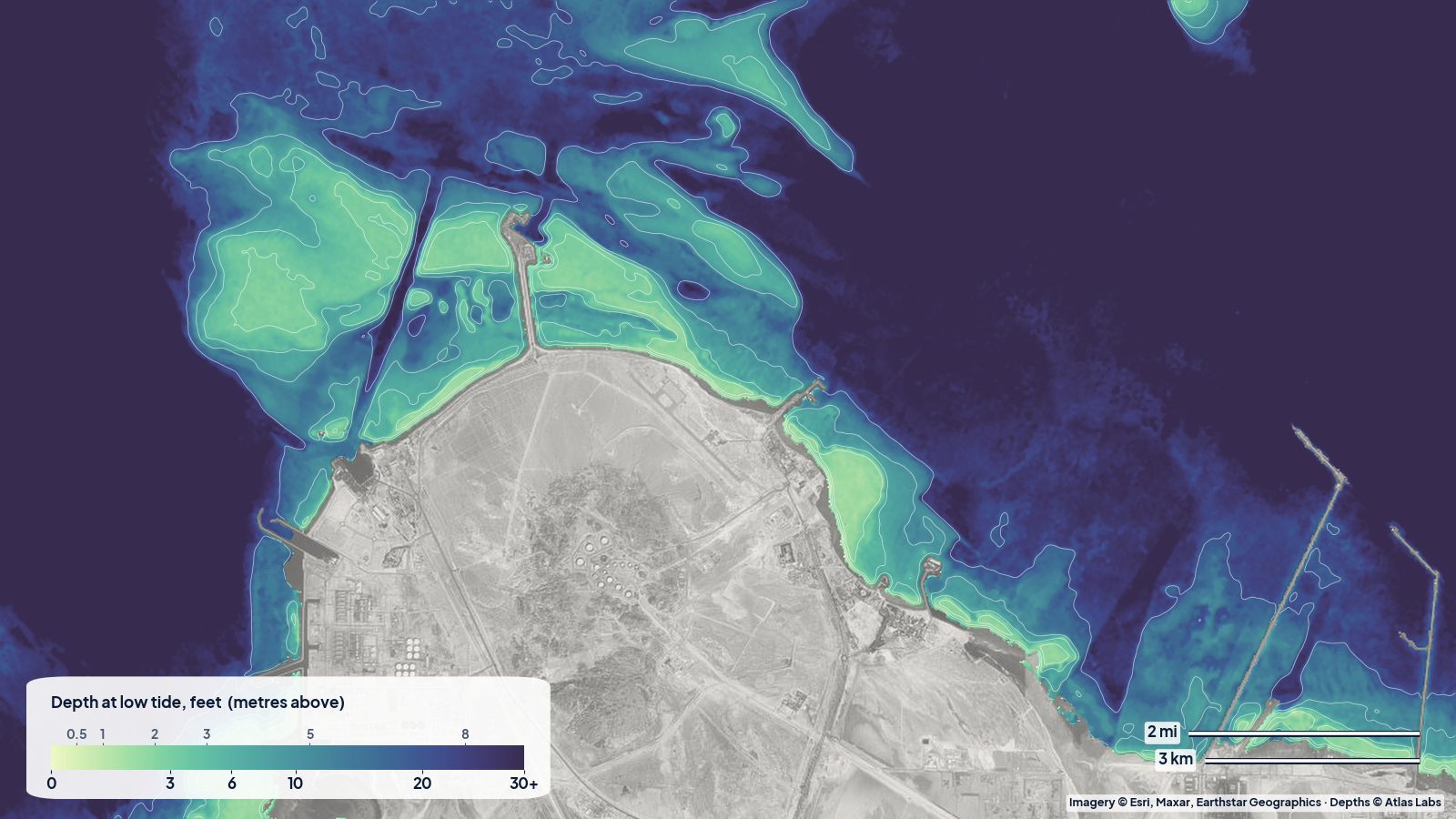
Depths are at low tide. The tide range here is modest, around 3 ft on springs. This map has a typical error of about 3 ft, which is good for seeing where the shallow beach water and the sand banks are, not for exact clearance.
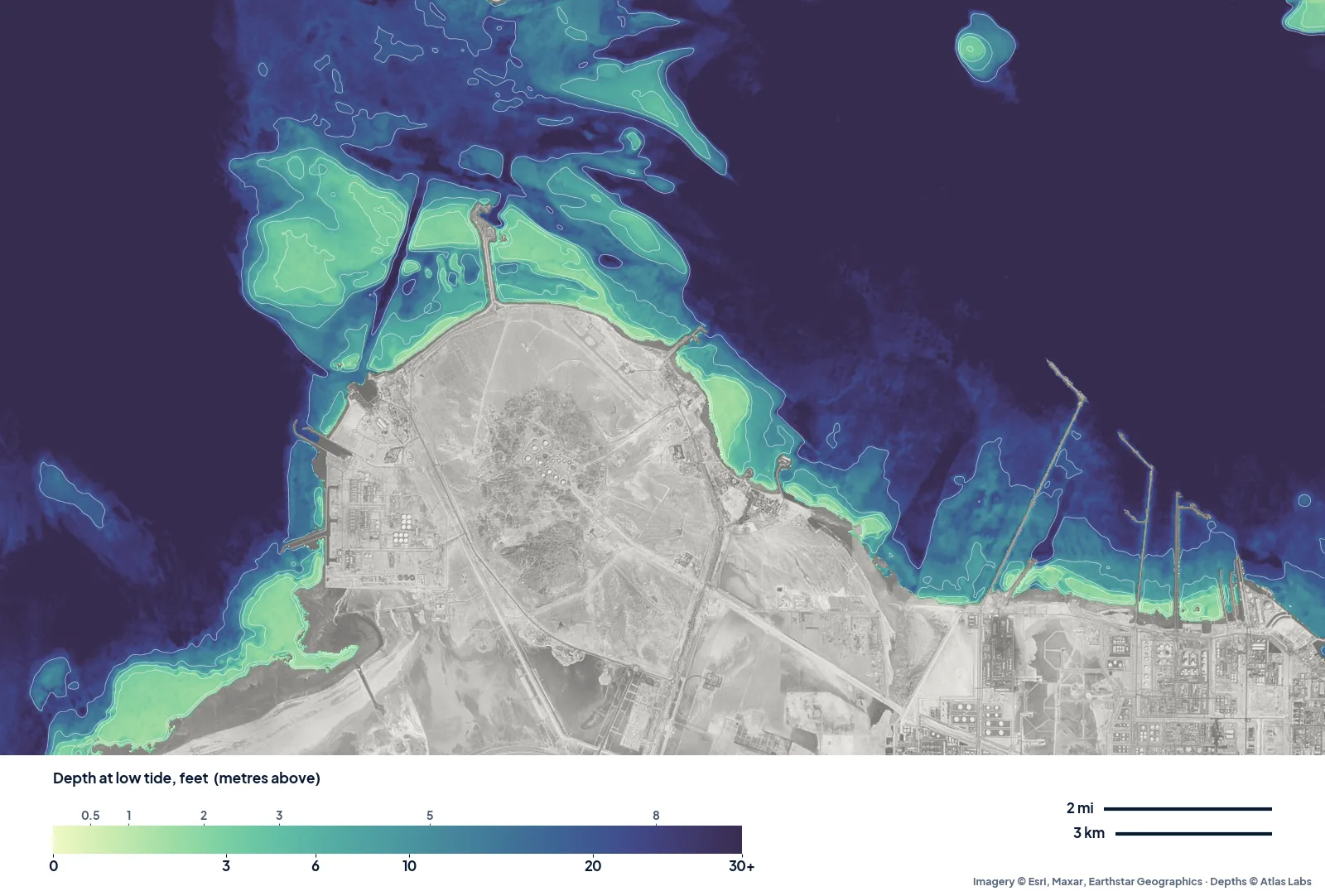
Jebel Dhanna at low tide. The headland is grey in the middle; the shallow sand banks spread north of it; the industrial jetties of Ruwais are on the right.
The beach on the north-east shore
The resort beaches sit on the north-east side of the headland, and the map shows why they are good for families: a pale band of very shallow water along the shore, reading about 2 ft at low tide close in and 5 ft or less a little further out, before it deepens toward the open Gulf. Calm, shallow, warm water, perfect for a first time on a paddleboard or kayak.
The sand banks to the north
North of the headland the map shows a broad area of banks and channels. Within a couple of miles of the northern tip, a quarter of the water reads under about 4.5 ft and half reads under about 15 ft, with deeper channels running between the banks. These banks are pale green on the map and easy to spot; on the water they show as a lighter turquoise in good light.
For a small boat, this is the area to take slowly. For paddlers, it is beautiful on a calm morning and exposed when the wind picks up, because there is nothing to stop the shamal (the north-west wind) once you leave the lee of the headland.
West of the headland and toward Ruwais
To the west of the headland the water deepens quickly, reading around 30 ft on the map. To the east, the coast in front of the Ruwais industrial area is lined with long jetties and port structures. Those areas are restricted: kayaks and small boats should keep well clear of the terminals, jetties and shipping.
When to go
October to April is the comfortable season, with warm water and milder air. Summer is very hot, and the water can exceed body temperature in the shallows. The shamal can blow strongly for days, mostly in winter and early summer; the beach on the north-east side is the most sheltered from it.
Open the live map
Tap any spot for the depth in feet: Jebel Dhanna live map. For other areas, see all spot hubs.
Frequently asked questions
Is the water shallow at Jebel Dhanna beach?
Yes. Along the resort beaches on the north-east shore, our map reads about 2 ft close in and 5 ft or less a little further out at low tide.
Can you kayak from Jebel Dhanna?
Yes, along the north-east beach and over the shallow banks north of the headland on calm days. Keep well away from the industrial jetties and shipping lanes to the east.
How deep is the water between Jebel Dhanna and Sir Bani Yas?
The banks north of the headland mix shallow sand (under about 5 ft) with deeper channels around 15 to 30 ft. Sir Bani Yas lies just north of the area this map covers.
Related reading
- La Maddalena, Palau and Porto Pollo depth map
- How accurate are satellite depth maps?
- Exumas sandbanks around Staniel Cay
Safety note: ShoalScope depth maps are satellite estimates for planning, not for navigation. Use official charts, follow local rules for restricted industrial areas, and always wear a life jacket.